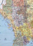
Extract from old maps of the Mongol empire at the time of the death of Kublai Khan including Myanmar ("Mien")

Click on the image below to see a more detailed map of
the most popular tourist spots of Myanmar - 225KB file
(courtesy of DPS Maps, Yangon, Myanmar)

map of popular tourist spots in myanmar

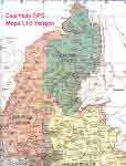
Click on the image below to see a more detailed
map of Northern Myanmar including Kachin State
and Sagaing Division - 205KB file
(courtesy of DPS Maps, Yangon, Myanmar)

map of northern myanmar including Kachin and Sagaing

Check out our tours and destinations by following the links at the left of your screen ~ email us by clicking on the BOOKING ENQUIRY button at the top left of your screen

We Take Good Care of You!!

February 14, 2012

HOME
Popular Tours
Designer
Tours
Booking Enquiry
Adventure & Specialist Tours
Cruises
Mandalay
Bagan
Pyin Oo Lwin
Yangon (Rangoon)
Mrauk U
Map on Myanmar
Beautiful Myanmar
Join our Mailing List
About Us
Myanmar Miscellany

Diving Holidays

Diving Trips

 hsipaw

 Archaeological Tours

mount popa

Birding tours

Peaceful Bagan

bagan

Trekking and Walking Tours

Golden Pagoda Travel Ltd ~
in conjunction with Road to Mandalay Ltd


Maps of Myanmar

Maps of Myanmar

Maps of Myanmar

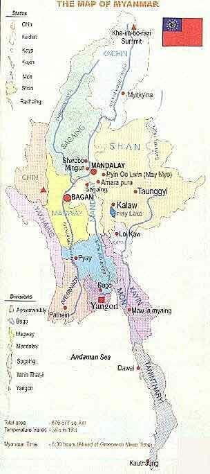
Maps of the whole country, the major tourist areas
and Myanmar ("Mien") at the time of the Mongol Empire

* 1,275 Miles from North to South *

myanmar map


Myanmar is a forest-clad mountainous country. In the northern part of the Country there are three parallel chains of mountain ranges beginning at the eastern extremity of the Himalayas and running from north to south: these are the Rakhine Yoma, the Bago Yoma and the Shan Plateau. In the northernmost extremity of Myanmar in Kachin State is Hkakabo-Razi which, at 5881 metres, is the highest mountain in South-East Asia. In the southern part of the Country there is the Tanintharyi Yoma. The northern mountain chains divide Myanmar into three major river systems: the Ayeyawady ("Irrawaddy"), the Sittoung and the Thanlwin. With these mountain chains and river systems, the country can be divided into seven major topographic regions: the Northern Hills, the Western Hills, the Shan Plateau, the Central Belt, the Lower Myanmar Delta, the Rakhine Coastal Region and the Tanintharyi Coastal Strip.

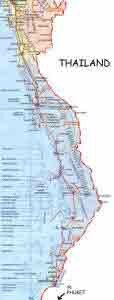
Click on the image below to see a more detailed map of the western coastal strip of Myanmar including the Myeik (Mergui) Archipelago where the Moken or Salone people ("Sea Gypsies") live
(courtesy of DPS Maps, Yangon, Myanmar)

map of southern myanmar