In 2004 the Myanmar government gave the go-ahead for the creation of the world's largest tiger reserve of 7,700 sq miles in the Hukawng Valley. Click here for more iunformation
|
The Virgin and Beautiful Hukawng Valley 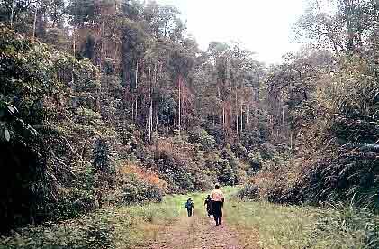 Travelling along the Ledo Road on Naga Mountain Range According to the British naturalist Frank Kingdon-Ward Myanmar is a plant hunter’s paradise. But the question is, is it true only for botanists? What about the zoologists who are trying to discover new species of animal life? Truly Myanmar is still very much undiscovered: much territory, especially up north, still remains to be explored. The Hukawng Valley straddling Tanaing Township in the Myitkyina District of Kachin State in the northernmost part of the country and the northern part of Nan-Yun Township Sagaing Division is indeed a natural paradise. The valley covers some 5,586 sq miles in area and is bounded to the north, east and west by towering mountain ranges and to the south by lower slopes. The Patkoi Mountain Range in the west forms the watershed area for the Chindwin and Brahmaputra Rivers. The Kumon Mountain Range on the east constitutes the watershed area and headwaters of the tributaries of the Chindwin and Ayeyarwady Rivers. Mountain streams from the catchment areas on the eastern and western ranges flow towards the plains of the Hukawng Valley, where they combine to become the largest tributary of the Chindwin, the Tanaing-kha. The Hukawng Valley held great promise as a possible candidate for Protected Area Status; and so in 1999, the Wildlife Conservation Society (WCS) based in the United States (which has been working with the Ministry of Forestry since 1994) mounted an expedition to the Hukawng Valley in collaboration with the Ministry of Forestry. The Expedition was led by Dr Alan Rabinowitz of WCS and included Saw Ttin Khaing and Than Myint from the Yangon WCS office, scientists from the Ministry of Forestry, the Ministry of Education, Myanmar Floriculturists Association and other support staff. There were 14 members in the Biological Expedition and the duration of the Expedition was from May 14 to 2 June 1999. Aims
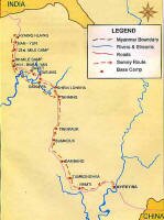
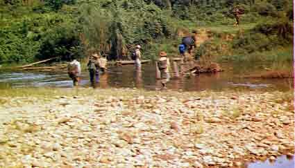
Myitkyina was designated as the staging area for the Expedition. All preparations were completed and the Expedition was ready to start on May 15 1999. The first part of the journey was easy: a distance of 120 miles by motor transport. After long and weary hours along the dusty and bumpy road we reached Tanaing which is a rather small town with just a cluster of houses and some government buildings. The Expedition rested for the night at Tanaing but most of us were unable to sleep thinking of the adventures we might encounter on our journey into the wilds of the Hukawng Valley. The next day everybody rose early; after a quick breakfast we were off. This time our destination was a town called Nun-Yun another 80 miles further on. It was tough going climbing steep razor-backed hills or descending deep into dark valleys. But everybody was busy with their designated tasks. The Expedition members were divided into 6 teams; the Mammology team, the Forestry team, the Orchid team, the Ornithology team, the Geology team and the Medical team.
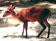
Dwarf deer The Mammology team was to determine the distribution of the extremely rare leaf deer (phet gyi) as well as those of the tiger, elephant and other species and also to investigate poaching of wild animals and estimate the prospects for the establishment of a protected area. The Mammology team was able to collect some skulls of the phet gyi, which is much smaller in size than ordinary deer species at Nant Lin village on the Patkoi Mountain Range. The village is about 12 miles from Nan-Yun and this discovery validated our theory that the leaf deer distribution range extends from Nongmon township in Putao district in the east then along the Kumon Mountain Range to Nan-Yun in the Hukawng Valley and extending further to the Patkoi Mountain Range in the extreme west of the country bordering India. Another discovery was that phet gyis are seen only at locations above 3,000 feet and they do not frequent low-lying areas. The Expedition also hoped to get a good collection of animal bones for future research but was disappointed with the poor quality of the bones they found along the way.
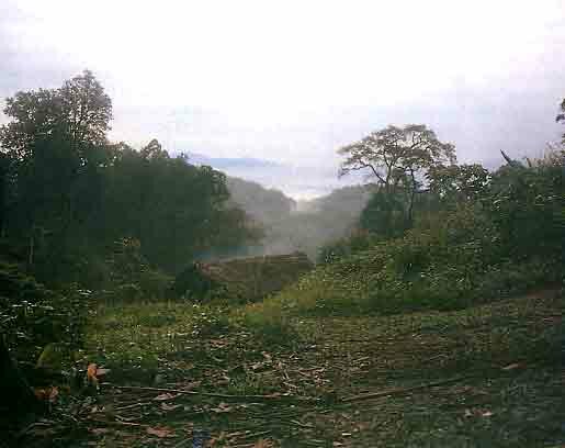
Tanaing Township consists mostly of low-lying plains with a few mountain ranges and slopes over 3,000 feet at some places. Annual rainfall is approximately 150 inches and the whole area is lush and green. The mountains and valleys are all covered with many commercially valuable tree species as well as rattan and bamboo breaks. The Hukawng Valley itself is an alluvial plain that is very fertile and suitable for cultivation of crops. However the local inhabitants state that agriculture is uneconomic and unfeasible due to periodic inundations of fields by heavy rainfall. Some gold panning is carried out but no suitable areas exist for large-scale commercial exploitation.
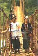
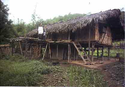
The villages along the way were mostly Kachin or Naga. The Kachin villages are either Christian or Buddhist as well as some with traditional beliefs; but the Nagas still cling to their age old customs. The villagers mostly engage in shifting cultivation that is very harmful to the environment. Hunting is however a secondary activity.
Draught animals Gene pool
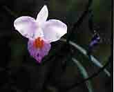
One factor that the Orchid team felt reassured about was that the local inhabitants showed no interest in the orchids nor was there any evidence of an orchid trade. The Ledo Road is one of the most significant engineering feats of World War II. This road was built by the Allies to deliver military supplies from India to China. The highway is 1,030 miles long and crosses some 700 bridges. The final stages of the road follows the original route taken by Marco Polo. The Myitkyina to Namti stretch of this road is an all-weather road. From Namti to Tanaing, the highway becomes an earthen fair-weather road. The 100 feet wide road from Tanaing to Shin-Bwae-Yan crosses relatively flat land and apart from some dilapidated bridges remains in reasonably good condition. The stretch from ShinBwae-Yan to Nun-Yun howevee runs through undulating terrain and is not very good. The Shin-Bwae-Yan airfield in spite of lack of maintenance for over 50 years can easily be made usable. On the return journey the Expedition came back by river from ShinBwae-Yan and arrived back at Tanaing on May 31 1999. The trip took approximately 17 days and was a great success: all the separate teams were able to fulfil their assigned tasks and thus came away satisfied. The headwaters of the numerous streams and tributaries that come together to form the Chindwin River (which is itself one of the major tributaries of the Ayeyarwady River) are all located within the Hukawng Valley. To date the Hukaung Valley is still pristine and beautiful; it is still covered with dense forest which is home to a variety of mammalian and avian species and very rich in biodiversity with ecosystems still intact as it is far removed from major human settlements. Apart from the zoologists and the biologists, this area would also have a great appeal for nature-lovers, and therefore holds great potential for development of ecotourism in the future because of its unspoilt environment; the sense of exploration with opportunities to see a variety of mammals and avian species in their natural habitat (many of which are on the endangered list) lends itself to this form of tourism. The Expedition also learnt that in December 1995 the Kachin State Forest Department had submitted to the Forest Department Headquarters in Yangon that 3,063sq miles around Tanaing Township be designated as a Protected Area. By incorporating the presently suggested area covering 2,494 sq miles into the proposed protected area submitted by the Kachin State Forest Department and establishing it as the Hukawng Valley Wildlife Sanctuary this would be a huge success for both scientists and nature lovers and for the country in general as it would raise the percentage of Protected Areas in the country to 3 percent. U SanwTun Khaing is the Country Coordinator of WCS Yangon Office and U Than Mvint is the Training coordinator. With thanks to the Myanmar Forestry Journal and the authors Addendum |
